


Via Solleder – Sass Maor
Description
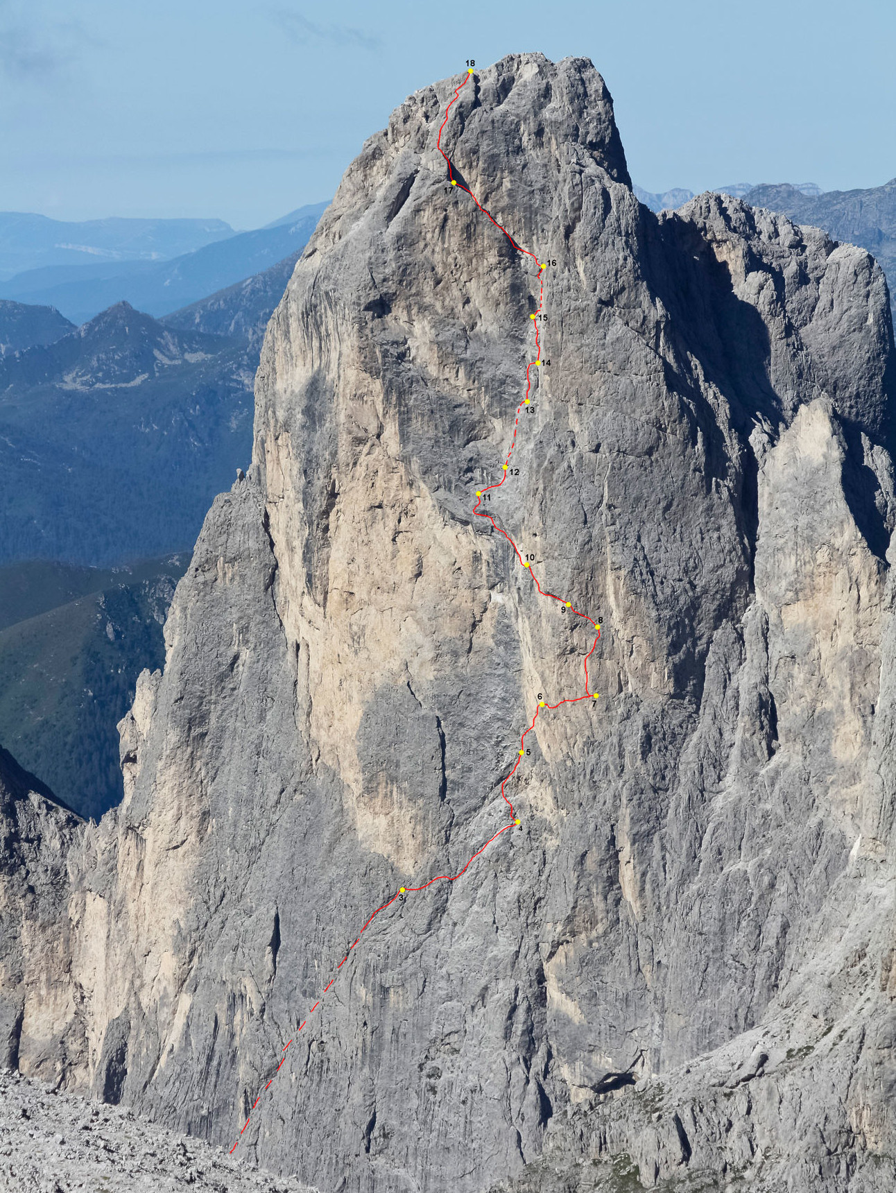
This medium-high difficulty climb is one of the great classic in the Dolomites. An excellent, very varied climbing in a wonderful scenery:. the route doesn’t start at the actual base of the wall, but on the vast South-Eastern shoulder near the little col where “Banca Orba” ends and “Diagonale Solleder” begins.
In 1926 even if he could have completed it, Solleder did not “solved” the entire route but just a part of it: this unresolved question has finally found an answer with Aldo Bettega!
You can get to the start of the route from Val Pradidali along the “Sentiero del Cacciatore” path, to the point just under the Eastern wall of Cima della Stanga. Leave the main footpath and follow a quite level well-marked path running North which will lead you back into the upper Val dei Pissotti. From here, there are two ways to get to Sella della Banca Orba: at a height traverse right, and go round the rock walls following a path which then goes all the way up to the steep bank until you reach the col. Second option: go up to the scree slope some easy rock walls to get under the SSE wall of Sass Maor at the bottom of a steep gully (near a deep cave and remains of a bivouac hut) which comes down from the col flanking the wall. Scramble up the first section of the gully (II+) on excellent smooth rocks and continue on easier terrain to the col (around 2250m ).
Three hours from the car park in Fosna. There is an alternative start: from the Velo Hut take the “Sentiero del Cacciatore” path, but in the opposite direction. Climb over the top of Cima della Stanga and go down into the Vallon dei Pissotti under the Eastern face, as far as the point where a quite level path heads North. Then continue as before. The climb begins at Sella della Banca Orba with a long diagonal cutting right across the wall with several sections of grade III and III+ on good rock. Be careful on the short stretch scree after “Castello di Onix”. A description of the walk-in and the topo replace the technical description.
Descent
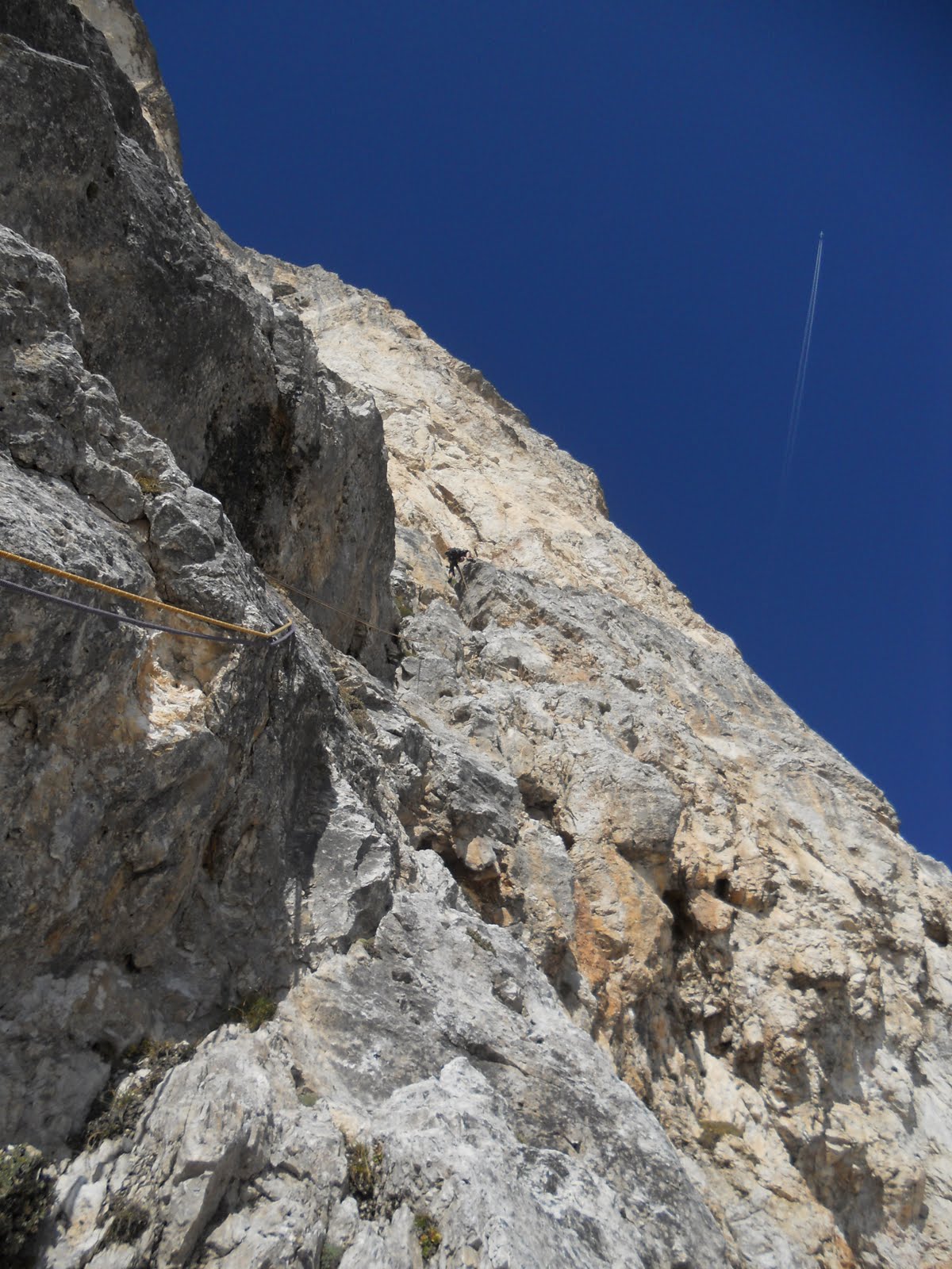
The normal route is easy to find as it is well signed and indicated with red markers. From the Top, head towards East and abseil down a step (a long one and 2 short 27m pitches). This will take you to a large slanting terrace: go down the slope around the North face above the col with Cima Madonna. Other two short abseil pitches or one long get you to the col. Go down the left-hand gully (South) until you get to a rock wedged in the gully. Go under it and you will quickly find yourself at the junction with the Pissotti gully. Take the clear route to the right and go down to the last rock face which you will need to abseil down (short pitch). From there it’s just a few minutes to the Refuge.
Descent 1,30 hours. Total time required 3,30 hours.